
展开层显示geoserver tiff过程中的一些问题
展开层显示geoserver tiff过程中的一些问题
提问于 2019-03-08 09:43:11
我试着使用openlayer来显示geoserver tif,但是它显示的不正确。以下是我的步骤:
- 例如,我从当地的geoserver中选择了一个tif (topp:states)
- 然后尝试用开放层api加载它。
const tifMap = (target) => {

new Map({
    target,
    pixelRatio: 1,
    layers: [
      new TileLayer({
        source: new TileWMS({
            url: 'http://localhost:8080/geoserver/topp/wms',
            params: {'LAYERS': 'topp:states',
                'BBOX': '-124.73142200000001,24.955967,-66.969849,49.371735',
                'CRS': 'EPSG:4326',
                'FORMAT': 'image/jpeg',
                'VERSION': '1.1.0'
            },
            serverType: 'geoserver'
        })

      })
    ],
    view: new View({
      center: [741189, -3741196],
      zoom: 4
    })
  })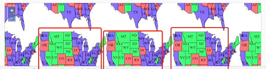
};- 不幸的是,几个相同的图像显示在div上,我不知道为什么,实际上我试图打开链接(打开层试图通过浏览器获取),它显示正常。
回答 1
Stack Overflow用户
发布于 2019-03-08 13:41:01
OpenLayers根据源选项中的投影集和用于TileWMS或ImageWMS的视图网格自动创建BBOX和CRS参数。最大范围可以设置在倾斜(在服务器投影单元)或在层(在视图投影单元)。假设服务器只支持EPSG:4326,并且希望以EPSG:3857的形式显示平铺输出,那么这两种方式都可以:
  new TileLayer({
    source: new TileWMS({
        url: 'http://localhost:8080/geoserver/topp/wms',
        params: {'LAYERS': 'topp:states',
            'FORMAT': 'image/jpeg',
            'VERSION': '1.1.0'
        },
        serverType: 'geoserver',
        projection: 'EPSG:4326'
    }),
    extent: transformExtent([-124.73142200000001,24.955967,-66.969849,49.371735], 'EPSG:4326', 'EPSG:3857')
  })
。
  new TileLayer({
    source: new TileWMS({
        url: 'http://localhost:8080/geoserver/topp/wms',
        params: {'LAYERS': 'topp:states',
            'FORMAT': 'image/jpeg',
            'VERSION': '1.1.0'
        },
        serverType: 'geoserver',
        projection: 'EPSG:4326',
        tilegrid: createXYZ({extent: [-124.73142200000001,24.955967,-66.969849,49.371735]})
    })
})页面原文内容由Stack Overflow提供。腾讯云小微IT领域专用引擎提供翻译支持
原文链接:
https://stackoverflow.com/questions/55060494
复制相关文章
相似问题
腾讯云开发者

Copyright © 2013 - 2026 Tencent Cloud. All Rights Reserved. 腾讯云 版权所有
深圳市腾讯计算机系统有限公司 ICP备案/许可证号:粤B2-20090059 ![]() 粤公网安备44030502008569号
粤公网安备44030502008569号
腾讯云计算(北京)有限责任公司 京ICP证150476号 | 京ICP备11018762号