
将EPSG:4326投影转换为EPSG:3857 mercator
将EPSG:4326投影转换为EPSG:3857 mercator
提问于 2017-06-19 08:02:31
我使用锐利地图从MSSQL渲染边框(几何图形)作为PNG图像。除了一些国家在平面图像格式上看上去太“宽”外,一切都很好。
据我所知,我需要创建到EPSG:3857投影的转换,但我不知道如何实现。
这是我的密码
 var map = new Map(new Size(request.Width, request.Height));
 map.BackColor = Color.Transparent;
 var countryGeometry = GeometryFromWKT.Parse(dto.CountryWkt);

 IProvider countryProvider = new GeometryFeatureProvider(countryGeometry);
 var countryLayer = new VectorLayer("country", countryProvider);
 var borderColor = System.Drawing.ColorTranslator.FromHtml("#525252");

 countryLayer.Style.EnableOutline = true;
 countryLayer.Style.Outline = new Pen(borderColor);
 countryLayer.Style.Fill = Brushes.Transparent;
 //does not work with this
countryLayer.CoordinateTransformation = new
                ProjNet.CoordinateSystems.Transformations.CoordinateTransformationFactory().CreateFromCoordinateSystems(
                    ProjNet.CoordinateSystems.GeographicCoordinateSystem.WGS84,
                    ProjNet.CoordinateSystems.ProjectedCoordinateSystem.WebMercator);

 map.Layers.Add(countryLayer);

 map.ZoomToBox(new Envelope(dto.Envelope.BottomLeft.Longitude,
            dto.Envelope.TopRight.Longitude,
            dto.Envelope.BottomLeft.Latitude,
            dto.Envelope.TopRight.Latitude
        ));

var img = map.GetMap();我们可以在这里找到https://pastebin.com/PEbpAdxT
任何帮助都是非常感谢的。
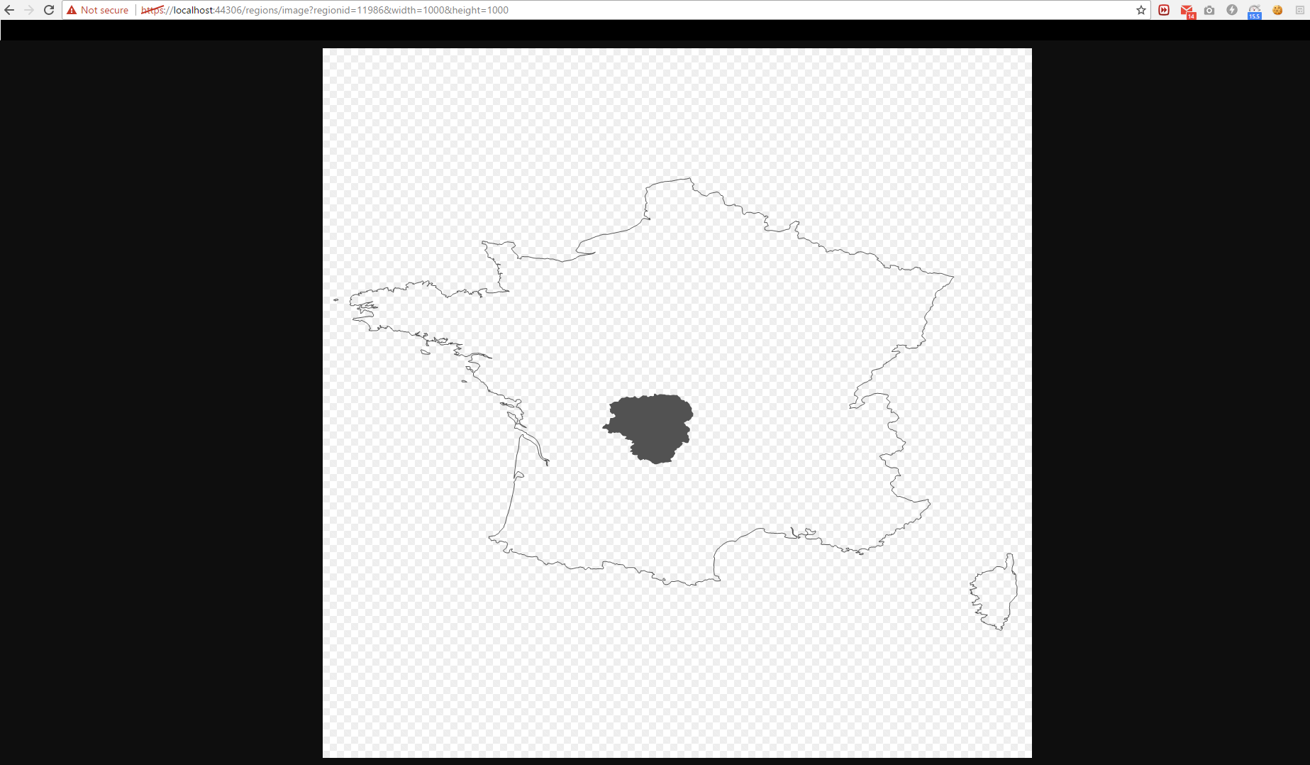
编辑:这是我现在得到的法国和它的地区"Limousin“的图像。如你所见,它太“宽”了。
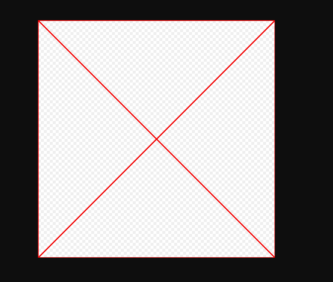
这是我应用转换时的图像,可以在代码注释does not work with this下面找到
编辑2
我也尝试过进行转换,但这会呈现空白的png (没有红十字会)。
 public  ICoordinateTransformation Wgs84toGoogleMercator
        {
            get
            {

                if (_wgs84ToGoogle == null)
                {
                    CoordinateSystemFactory csFac = new ProjNet.CoordinateSystems.CoordinateSystemFactory();
                    CoordinateTransformationFactory ctFac = new CoordinateTransformationFactory();

                    IGeographicCoordinateSystem wgs84 = csFac.CreateGeographicCoordinateSystem(
                      "WGS 84", AngularUnit.Degrees, HorizontalDatum.WGS84, PrimeMeridian.Greenwich,
                      new AxisInfo("north", AxisOrientationEnum.North), new AxisInfo("east", AxisOrientationEnum.East));

                  // var a =  csFac.CreateFromWkt("aa");


                    List<ProjectionParameter> parameters = new List<ProjectionParameter>();
                    parameters.Add(new ProjectionParameter("semi_major", 6378137.0));
                    parameters.Add(new ProjectionParameter("semi_minor", 6378137.0));
                    parameters.Add(new ProjectionParameter("latitude_of_origin", 0.0));
                    parameters.Add(new ProjectionParameter("central_meridian", 0.0));
                    parameters.Add(new ProjectionParameter("scale_factor", 1.0));
                    parameters.Add(new ProjectionParameter("false_easting", 0.0));
                    parameters.Add(new ProjectionParameter("false_northing", 0.0));
                    IProjection projection = csFac.CreateProjection("Google Mercator", "mercator_1sp", parameters);

                    IProjectedCoordinateSystem epsg900913 = csFac.CreateProjectedCoordinateSystem(
                      "Google Mercator", wgs84, projection, LinearUnit.Metre, new AxisInfo("East", AxisOrientationEnum.East),
                      new AxisInfo("North", AxisOrientationEnum.North));

                    ((CoordinateSystem)epsg900913).DefaultEnvelope = new [] { -20037508.342789, -20037508.342789, 20037508.342789, 20037508.342789 };

                    _wgs84ToGoogle = ctFac.CreateFromCoordinateSystems(wgs84, epsg900913);
                }

                return _wgs84ToGoogle;

            }
}回答 1
Stack Overflow用户
回答已采纳
发布于 2017-06-21 15:00:09
您使用的CoordinateTransformation实际上是有效的。
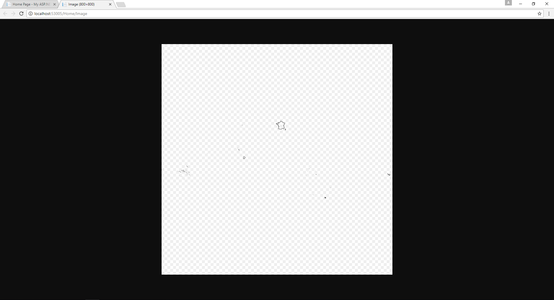
因为您的ZoomToBox坐标是错误的,所以您得到的是空白图像,因此它实际上显示了图像的空白部分。如果您使用map.ZoomToExtents();函数,在缩放之前查看整个图像,它如下所示:
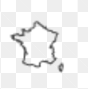
现在,如果我手动放大浏览器以获得应用此转换的法国特写图像,您可以看到它实际上已经不再拉伸了。
总之,我要说的是,您只需要修复ZoomToBox坐标,一切都会正常工作。希望能帮上忙。:)
页面原文内容由Stack Overflow提供。腾讯云小微IT领域专用引擎提供翻译支持
原文链接:
https://stackoverflow.com/questions/44625176
复制相关文章
相似问题
腾讯云开发者

Copyright © 2013 - 2026 Tencent Cloud. All Rights Reserved. 腾讯云 版权所有
深圳市腾讯计算机系统有限公司 ICP备案/许可证号:粤B2-20090059 ![]() 粤公网安备44030502008569号
粤公网安备44030502008569号
腾讯云计算(北京)有限责任公司 京ICP证150476号 | 京ICP备11018762号