
R-向rMaps添加多个标记
R-向rMaps添加多个标记
提问于 2015-09-27 00:56:55
问题
如何使用rMaps添加多个标记
数据
coords <- structure(list(stop_id = 19841:19843, stop_name = c("Flagstaff Railway Station (Melbourne City)",
"Melbourne Central Railway Station (Melbourne City)", "Parliament Railway Station (Melbourne City)"
), stop_lat = c(-37.8119813073807, -37.8099387667386, -37.8110540555305
), stop_lon = c(144.955653760429, 144.962593535096, 144.972910916416
)), .Names = c("stop_id", "stop_name", "stop_lat", "stop_lon"
), sorted = "stop_id", row.names = 17:19, class = c("data.table",
"data.frame"))
示例
使用library(rMaps),我可以创建一个地图并添加一个标记,如Ramnath的github页面上的示例所示:
library(rMaps)

l <- Leaflet$new()
l$setView(c(-37.8602828, 145.079616), zoom=11)
l$tileLayer(provider = "Acetate.terrain")

## add one marker:
l$marker(LatLng = c(-37.81198,144.9557))但是,我想不出如何从coords数据框架中添加多个标记,而不为每个标记都编写一个l$marker行。
我尝试过使用GeoJSON,但是我是新手,所以我还没有意识到这一点,肯定做错了什么。
# library(rgdal)
# coords.sp <- SpatialPointsDataFrame(coords[,.(stop_lon, stop_lat)], coords[,.(stop_id, stop_name)])
# writeOGR(obj=coords.sp, dsn='coords.geojson', layer='OGRGeoJSON', driver='GeoJSON')

# gj <- readOGR("./coords.geojson", layer="OGRGeoJSON")
# l$geoJson(gj)
# l$geoJson("./coords.geojson")如果JSON/GeoJSON是可行的话,我很乐意使用它。
期望输出
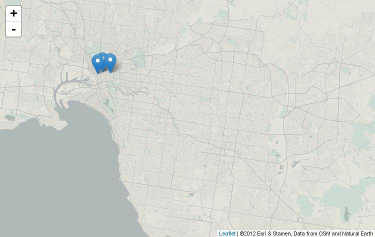
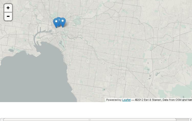
我希望结果与使用library(leaflet)显示多个标记的结果相同
library(leaflet)
leaflet() %>%
  addProviderTiles("Acetate.terrain") %>%
  setView(lat = -37.8602828, lng = 145.079616, zoom=11) %>%
  addMarkers(data=coords, lat=~stop_lat, lng=~stop_lon)
GeoJSON
下面是从GeoJSON命令生成的writeOGR代码,我已经验证了它的在GeoJSONLint
{
"type": "FeatureCollection",

"features": [
{ "type": "Feature", "id": 1, "properties": { "stop_id": 19841, "stop_name": "Flagstaff Railway Station (Melbourne City)" }, "geometry": { "type": "Point", "coordinates": [ 144.955653760428987, -37.811981307380698 ] } },
{ "type": "Feature", "id": 2, "properties": { "stop_id": 19842, "stop_name": "Melbourne Central Railway Station (Melbourne City)" }, "geometry": { "type": "Point", "coordinates": [ 144.962593535096005, -37.809938766738597 ] } },
{ "type": "Feature", "id": 3, "properties": { "stop_id": 19843, "stop_name": "Parliament Railway Station (Melbourne City)" }, "geometry": { "type": "Point", "coordinates": [ 144.972910916415998, -37.811054055530498 ] } }
]}回答 1
Stack Overflow用户
回答已采纳
发布于 2015-09-27 04:52:43
我可以使用library(geojsonio)正确读取GeoJSON文件,然后使用l$geoJson将标记加载到地图上。
## create spatial object and save as GeoJSON
# library(rgdal)
coords.sp <- SpatialPointsDataFrame(coords[,.(stop_lon, stop_lat)], coords[,.(stop_id, stop_name)])
writeOGR(obj=coords.sp, dsn='coords.geojson', layer='OGRGeoJSON', driver='GeoJSON')

l <- Leaflet$new()
l$setView(c(-37.8602828, 145.079616), zoom=11)
l$tileLayer(provider = "Acetate.terrain")

## Read the GeoJSON data
library(geojsonio)
gj <- geojson_read("./coords.geojson")
l$geoJson(gj)
页面原文内容由Stack Overflow提供。腾讯云小微IT领域专用引擎提供翻译支持
原文链接:
https://stackoverflow.com/questions/32803531
复制相关文章
相似问题
腾讯云开发者

Copyright © 2013 - 2026 Tencent Cloud. All Rights Reserved. 腾讯云 版权所有
深圳市腾讯计算机系统有限公司 ICP备案/许可证号:粤B2-20090059 ![]() 粤公网安备44030502008569号
粤公网安备44030502008569号
腾讯云计算(北京)有限责任公司 京ICP证150476号 | 京ICP备11018762号