
如何读取R中的Mapinfo文件
如何读取R中的Mapinfo文件
提问于 2013-11-20 16:14:33
法国国家研究所(Insee)以MapInfo格式提供地理数据( .mid和.mif两个文件和一个dbf文件)。我怎么读R里的那些文件?
这里有一个示例。
回答 2
Stack Overflow用户
回答已采纳
发布于 2013-11-20 18:54:47
MapInfo文件有一个OGR驱动程序(包rgdal):
R> library("rgdal")
R> ogrDrivers()[28, ]
           name write
28 MapInfo File TRUE但是您的文件/几何图形有问题,readOGR给出了错误消息:
R> ogrListLayers("R02_rfl09_UTM20N1000.mid")
[1] "R02_rfl09_UTM20N1000"

R> readOGR("R02_rfl09_UTM20N1000.mid", layer="R02_rfl09_UTM20N1000")
OGR data source with driver: MapInfo File
Source: "R02_rfl09_UTM20N1000.mid", layer: "R02_rfl09_UTM20N1000"
with 967 features and 4 fields
Feature type: wkbPolygon with 2 dimensions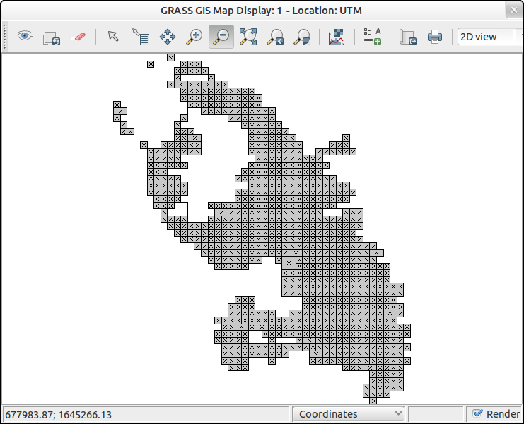
Error in stopifnot(is.list(srl)) : ring not closed但是,我能够用GRASS GIS读取文件,这些文件可以从R (package spgrass6)中编写脚本:
v.in.ogr dsn=R02_rfl09_UTM20N1000.mid output=R02_rfl09_UTM20N1000 snap=1e-08
Stack Overflow用户
发布于 2013-11-20 17:22:10
这有点难说,因为您的pdf只定义了.mid结构。
这取决于您想要对日期做什么,但是查看它,.mid文件有每个区域的SW坐标,并且检查.mif文件,每个区域是1000m2,所以您可以只计算这些区域(对于这个数据样本),而不是加载它们。
因此,这里有一种加载它的方法,但是它将取决于您想要对数据做什么
首先将.csv文件复制到您的工作目录中,然后
coords<-read.csv(file="R02_rfl09_UTM20N1000.mid", header=FALSE)
colnames(coords)<-c("SW.E","SW.N","ind","indXYNE1")
# add the co-ords for the area
coords$SE.N=coords$SW.N
coords$SE.E=coords$SW.E+1000
coords$NW.N=coords$SW.N+1000
coords$NW.E=coords$SW.E
coords$NE.N=coords$SW.N+1000
coords$NE.E=coords$SW.E+1000

head(coords)
这将给你:
    SW.E    SW.N ind indXYNE1    SE.N   SE.E    NW.N   NW.E    NE.N   NE.E
1 690000 1636000 241        6 1636000 691000 1637000 690000 1637000 691000
2 690000 1637000 414        3 1637000 691000 1638000 690000 1638000 691000
3 690000 1638000 240        6 1638000 691000 1639000 690000 1639000 691000
4 690000 1640000   8        0 1640000 691000 1641000 690000 1641000 691000
5 691000 1634000 142        0 1634000 692000 1635000 691000 1635000 692000
6 691000 1635000 216        5 1635000 692000 1636000 691000 1636000 692000
....
哪个是每个区域的四个边界点,再加上ind和indXYNE1,我猜这就是你想要的?然后,您可以使用SW点(或新派生键)作为每个区域的引用来转换数据。
希望这能帮上忙!这在一定程度上取决于您想对数据做什么。
页面原文内容由Stack Overflow提供。腾讯云小微IT领域专用引擎提供翻译支持
原文链接:
https://stackoverflow.com/questions/20101083
复制相关文章
相似问题
腾讯云开发者

Copyright © 2013 - 2026 Tencent Cloud. All Rights Reserved. 腾讯云 版权所有
深圳市腾讯计算机系统有限公司 ICP备案/许可证号:粤B2-20090059 ![]() 粤公网安备44030502008569号
粤公网安备44030502008569号
腾讯云计算(北京)有限责任公司 京ICP证150476号 | 京ICP备11018762号