
控制来自形状文件的邻近多边形中海龟的行为
你能帮我解决下面的网络标识问题吗?以下是我的问题:
- 每个农民都由一只海龟
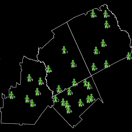
- 农民在县多边形边界内随机创建,该多边形是从形状文件中导入的。该形状文件具有显示每个县中农民no (FarmNo)的属性。这些数字被用来选择随机的农民(请看图片)。
- I创建了一个文本文件Neighbor.text,它包含每个多边形的信息和相邻多边形的id。
- ,我需要为每个相邻的县创建农民的代理集,在每个代理集合中,农民的数量将由他们自己的县内的农民和他们的邻近的
- ,农民有一个采用的阈值AT。现在,如果农民在附近的农民中的收获率高于他的AT值,那么农民将是积极的。
- I应用下面的代码创建了具有形状文件的世界,导入了邻居信息,并在多边形内部创建了农民。但是,我错过了在邻近县创建农民代理集的机会。
extensions [gis]

globals [
  GA-dataset  ;; the shape file
  ]
patches-own [
  ID     ;;patch ID is identical with polygon ID_ID
  farm          ;;number of farmers in each county
  myneighbors  ;;neighboring polygons'
  AR ;; adoption ratio
    ]
turtles-own [
  tId ; id of each farmer
  AT ; adoption threshold
  tneighbors ; an agentset of its neighbor turtles
  positive  ; if AR > AT
]

to setup
  ca
  reset-ticks

  set GA-dataset gis:load-dataset "County.shp"
  gis:set-world-envelope gis:envelope-of GA-dataset

  gis:apply-coverage GA-dataset "CODE" ID
  gis:apply-coverage GA-dataset "FARMNO" farm

  file-close
  file-open "Neighbor.txt"

  while [not file-at-end?] [
    let x file-read let y file-read
    ask patches with [ID = x ] [
      set myneighbors ( patch-set myneighbors patches with [ID = y ] )
    ]
  ]
file-close

  foreach gis:feature-list-of GA-dataset [ feature ->

    let target-patches ( patches gis:intersecting feature ) with [ gis:contained-by? self feature ]
     ; Get the number of turtles that should be in each target-patch:
      let farm1 round gis:property-value feature "FarmNo"

    if any? target-patches [

     gis:create-turtles-inside-polygon feature turtles farm1 [
        set tID who
        set shape "person"
        set color green
        set size 2
        ]
    ]
  ]

 ask turtles [
    set AT random-normal 0.2  0.1920
    set label precision AT 2
    ]
  ask patches [
  set AR 0
   ]
  ask turtles [
set tneighbors [myneighbors] of patch-here
]
  ;; Draw boundary
  gis:set-drawing-color white
  gis:draw GA-dataset 1

end

to go
  ask turtles [
  set positive count tneighbors with [AT <= AR]
  ]
  if ticks = 11 [stop]
  tick
end回答 1
Stack Overflow用户
发布于 2022-06-26 19:21:34
这个模型中似乎有四种不同的实体:
Areas
- Counties
- Farms
- (Kinds
- 单位的作物(可能?或者我们只看一种crop?)
- Adopted作物(可能吧?)还是我们只看一种作物?)
。
单位土地面积(ULA)
location
- Provide中的
- 被空间地排列和固定在farms
- Contain县的ID信息的源数据
- 中,因此可以用来定义counties
。
- 实现为修补程序
县
ULAs (patches)
- Defined通过ULA上的县ID在源数据
- 中包含
- ,因此,从ULAs
- 继承的空间信息与相邻的县有关系,在文本file
- Maintain记录中将county
- Implemented中的农民的作物适应率定义为一种海龟,每县一只。
农场
(patch)
- Adopt作物中的
- 来自于
- 的种类,在一个县的
- 也受到其他农场的选择的影响。包括来自邻近counties
的
- 是一种海龟品种--每个农场一只。
粮食作物
archetype
- Used
- 定义了由各县提供给农场
- an
- 的哪些作物来保存收养率记录
- 可以将其种类的
- 计算为一种海龟,每种作物
- 农场链接到各种作物
F 275
采用作物
由农场countable
- Implemented
- 采用的
- 必须是有向链接品种,农场
- 农场采用的每一种作物使用该链接可以链接到各种作物,如果采用的作物有任何统计数据(单位面积的产量百分比、价值,不管是什么),它们都属于采用的作物链接。
<代码>H 187农场可以采用多种H 288/code>H 189也可以被各州用来方便地管理每种作物的statistics
terrible名称,对不起,可能是“种植”或“选择”或其他什么?H 292
有了这些,你就可以很容易地得到如下的答案:
考虑到本县和邻近的counties?
What作物在neighborhood?
What中的AR值最高的是每种作物的AR值是什么?
。
这些问题在代码中会被问到,比如:
;; show top neighborhood crop for each county
ask counties
[
  show [ label ]
    of max-one-of
         crops
         [ count
           [ my-adopted-crop-neighbors ]
           of [ neighborhood-farms ]
             of myself
         ]
]
看上去很复杂,但根据关系由简单的部分组成。
注意:由于NetLogo自己使用的补丁和链接“邻居”,以及该模型在县使用“邻居”和“邻里”,所以有很大的人为混淆的空间。考虑使用一个替代词,或者用不那么令人困惑的记者来包装网络徽标的混淆名称。就像to-report my-plantings report my-adopted-crop-neighbors end
要清楚的是:除非你想要具体的可视化一些东西,只有补丁和农场是可见的(甚至农场可能只是一个彩色的正方形,也许意味着顶部作物的采用)。
即使只有一种作物,这是一个是/否的问题,你仍然可以利用种类和采用的品种进行簿记。
下面的代码是如何设置这样一个代理系统的示例。实际上,它编译时没有错误。可以随意使用任何有帮助的东西。
extensions [gis]

globals
[
  GA-dataset  ;; the shape file
]

breed [ Counties County ]
breed [ Farms Farm ]
breed [ Crops Crop ]
directed-link-breed [ Adopted-Crops Adopted-Crop ]

patches-own
[
  p-ID      ;; ID of the patch's county from the source data
  p-county  ;; points to the patch's county turtle
  farm-count ;; count of farms in this patch
  AR        ;; adoption ratio (is this a patch-level value or a county one?)
]

farms-own
[
  f-ID      ;; ID of the county from the source
  f-County  ;; points to the farm's county turtle
  AT        ;; adoption threshold (per crop?)
            ;; (is this a farm-level value or a county value?)
            ;; is this one value or set of values? (ie, all the crops)
            ;; if this is per-crop (a list), then this is eliminated
            ;; by the adopted crops
  positive  ;; if AR > AT ;; same-- this may be a per-crop value
]

Crops-Own
[ ;; label ;; use the built in label for values like "oranges" or "corn"
  ;; add variables as needed for things like..
  ;; cost
  ;; market-value
  ;; adoption-preference
  ;; etc.
]

Adopted-Crops-Own
[ ;; add variables for per-farm or per-county things like:
  ;; % of production
  ;; production amount?
  ;; label -- copy the label from the Crop,
  ;; this will probably be convenient to have
]

counties-own
[ county-ID      ;; ID number of the county from Source
  county-patches ;; patches in this county
  border-patches ;; set of patches on the border of the country
                 ;; useful to draw the map
                 ;; and later may be useful for visualization
                 ;; that needs to highlight a county
  county-farms   ;; farmers in this country
  county-crops   ;; unless it frequently changes membership,
                 ;; the set of all adopted-crops links for all my farms

  adjacent-counties  ;; set of counties sharing a border
  adjacent-farms     ;; set of farms from those counties
  neighborhood       ;; set of this and adjacent counties
  neighborhood-farms ;; farms in this and adjacent counties
  neighborhood-crops ;; crops adopted in this and adjacent counties
                     ;; any other county-level variables, like adoption rate history
]

to setup-patches-from-GIS
  set GA-dataset gis:load-dataset "County.shp"
  gis:set-world-envelope gis:envelope-of GA-dataset

  gis:apply-coverage GA-dataset "CODE" p-ID
  gis:apply-coverage GA-dataset "FARMNO" farm-count
end

to setup-counties
  let list-of-county-ids remove-duplicates [ p-ID ] of patches
  foreach list-of-county-ids
  [ $ID ->
    create-counties 1
    [ set county-ID $ID
      set county-patches patches with [ p-ID = $ID ]
    ]
  ]
end

to setup-county-neighbors
  ask counties
  [ set adjacent-counties no-turtles
  ]
  file-close-all
  file-open "Neighbors.txt"
  while [ not file-at-end? ]
  [
    let $a file-read
    let $b file-read
    let $AA one-of counties with [ county-ID = $a ]
    let $BB one-of counties with [ county-ID = $b ]
    ask $AA [ set adjacent-counties ( patch-set $BB adjacent-counties) ]
    ask $BB [ set adjacent-counties ( patch-set $AA adjacent-counties) ]
  ]
  set neighborhood ( patch-set self adjacent-counties )
  file-close
end

to setup-crops
  let crop-list
  [
    [ "apples"    ] ;; include any other per-crop values to initialize
    [ "oranges"   ] ;; you could also store this list is a file
    [ "rice"      ]
    [  "beans"    ]
    [ "coffee"    ]
  ]
  foreach crop-list
  [ crop-data-row ->
    create-Crops 1
    [ hide-turtle
      set size 0
      set color black
      set heading 0
      set label item 0 crop-data-row
      ;; set other-property item 1 crop-data-row
      ;; etc
    ]
  ]
end

to setup-farms
  ;; this is confusing... did we not already
  ;; load ID and farmno into the patches?
  ;; so.. can we just use that?

  ask patches with [ farm-count > 0 ]
  [ sprout-farms farm-count
    [ set f-ID p-ID
      set f-county p-county
      set shape "person"
      set color green
      set heading 0
      set size 0
    ]
  ]
  ;; setup adopted-crops
  ask farms
  [ create-adopted-crops-to crops
    [ hide-link
    ]
  ]

  ;;foreach gis:feature-list-of GA-dataset
  ;;[ feature ->
  ;;  let target-patches ( patches gis:intersecting feature )
  ;;     with [ gis:contained-by? self feature ]
  ;; ;; Get the number of turtles that should be in each target-patch:
  ;;  let farm1 round gis:property-value feature "FarmNo"
  ;;  if any? target-patches
  ;; [
  ;;    gis:create-turtles-inside-polygon feature turtles farm1
  ;;    [
  ;;      set t-ID who
  ;;      set shape "person"
  ;;      set color green
  ;;      set size 2
  ;;      set t-county one-of counties with [ county-ID =
  ;;      ]
  ;;  ]
  ;; ]
end

to setup-farm-data
  ask farms
  [
    set AT random-normal 0.2  0.1920
    set label precision AT 2
  ]
  ask patches
  [
    set AR 0
  ]
end

to update-county-datasets
  ask counties
  [ let this-ID county-ID
    set border-patches county-patches with
    [ any? neighbors with [ p-ID != this-ID ]
    ]
    set county-farms farms-on county-patches
    set county-crops (link-set [ my-adopted-crops ] of county-farms)
  ]
  ask counties
  [
    set adjacent-farms (turtle-set [ county-farms ] of adjacent-counties)
    set neighborhood-farms (turtle-set [ county-farms ] of neighborhood)
    set neighborhood-crops ( link-set [ my-adopted-crops ] of neighborhood-farms)
  ]
end


to draw-boundaries
  ;; Draw boundary
  gis:set-drawing-color white
  gis:draw GA-dataset 1
end

to setup
  setup-patches-from-GIS
  setup-counties
  setup-county-neighbors
  setup-crops
  setup-farms
  setup-farm-data
  update-county-datasets
  draw-boundaries
endhttps://stackoverflow.com/questions/72695601
复制相似问题
腾讯云开发者

Copyright © 2013 - 2026 Tencent Cloud. All Rights Reserved. 腾讯云 版权所有
深圳市腾讯计算机系统有限公司 ICP备案/许可证号:粤B2-20090059 ![]() 粤公网安备44030502008569号
粤公网安备44030502008569号
腾讯云计算(北京)有限责任公司 京ICP证150476号 | 京ICP备11018762号